Internet service has been hit or miss here in the high country. I'll get everyone caught up on the adventures once we get back to home base.

Internet service has been hit or miss here in the high country. I'll get everyone caught up on the adventures once we get back to home base.
Tomorrow we head out for Colorado. The Jeep is tuned and torqued, our gear is staged for loading, our bags are packed, and camera gear ready. Our itinerary starts bright and early tomorrow for a two day ride to Ouray.
Keep watching for daily updates, photos and videos!!

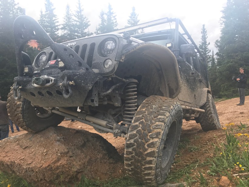
This was shot in May 2016 when we visited Moab. Onion Creek Trail is a 11.5 mile moderately trafficked trail that features a river, a few creek crossings and is rated as moderate. The route meanders from Onion Creek up one of several drainages to the edges of Fisher Towers. It’s condition can be graded smooth dirt to 4×4 bumpy depending upon recent storms and flooding. The trail itself offers some dusty dirt sections, then some slick rock with small shelves adding some challenges. Drainage off the mesa top above add constant changes at their crossings. Onion Creek trail then leads on to Rose Garden Hill which is rated 7/10
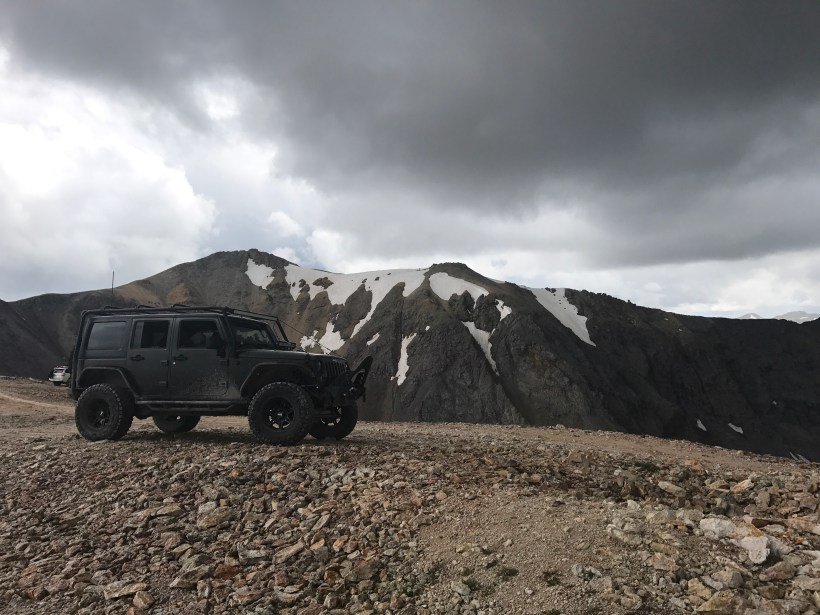
In less than 10 days we strike out for Colorado. This isn’t our first trip to Colorado, but it will be like none of the other past trips. We are driving The Tank out along with several of our other friends to Ouray, known as “The Jeeping Capital of the World.” There we’ll spend about five days hitting the trails, sight seeing, and enjoying some time away from work :-).
Please keep up with our adventures as we will try to post a video or photo daily!

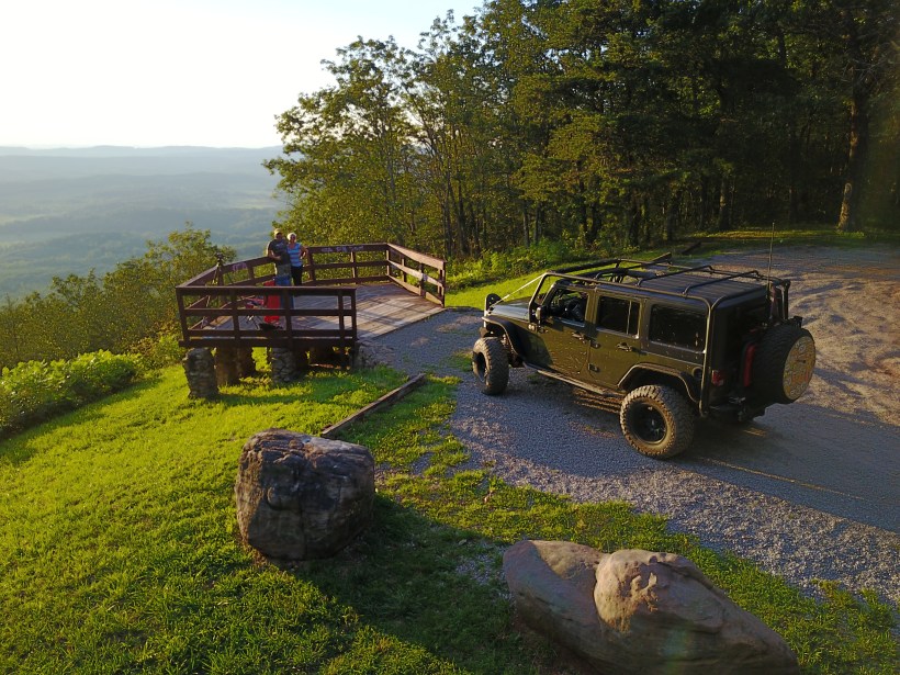
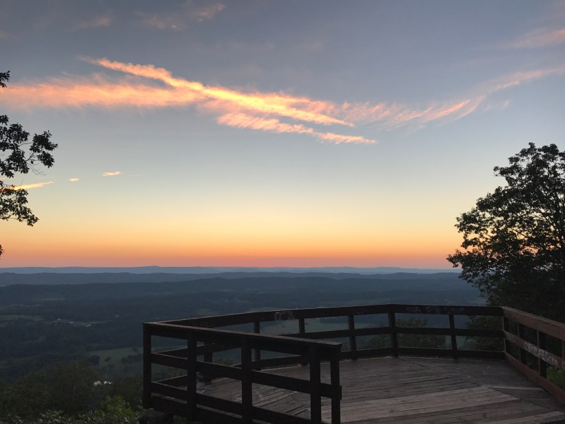
This past Sunday we took a drive up to Walker County to check out Johns Mountain WMA, the scenic overlook, and The Pocket. Plenty of Forest Service Roads in the area, camping, hiking, and even a shooting range. The scenic overlook is well worth the drive up to catch a sunset, or star gaze!!
Some photos from the ride.


Over the weekend we took a ride up to North Carolina with some friends to run Shelton Laurel Road, Hurricane Creek Road, and then up to Max Patch. We met up with Micheal and Rita, and Stuart and Jennifer in Franklin, NC. From there we headed North!

The underpass of I-40 on Shelton Laurel Road.

Some Patriotic Spirit of some of the property owners on Hurricane Creek.

Rhododendron were still in bloom and covered the mountain sides all along the ride. I know my mother would have loved to see them in bloom.

Bark mushrooms typically grow in the form of conk, also called a bract or shelf. These most often grow in cool, rainy coastal areas and on the shady, north side of trees. ( so remember, if your lost, and find these – you’ll know what direction North is)

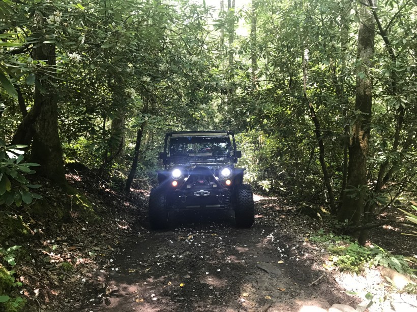

The road gets a little rocky and uneven in places. I would recommend a high clearance vehicle for this road.

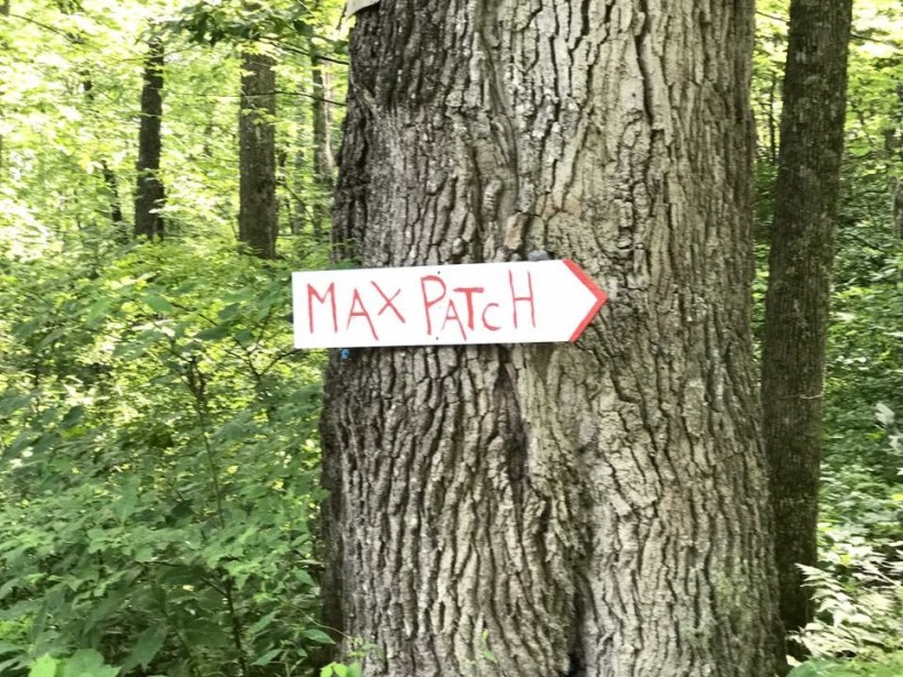
Onward and upward to Max Patch.
A view from the bottom of Max Patch. This 4,600-foot mountain was cleared and used as pasture in the 1800s. Today, it’s a 350-acre tract of open land on a high knob with 360-degree views. On a clear day, you can see from Mt. Mitchell on the east to the Great Smoky Mountains on the south. And great for star gazing and enjoying wildflowers. The summit is a short walk from the parking lot. Max Patch is part of the Pisgah National Forest.

Half way up to the Summit.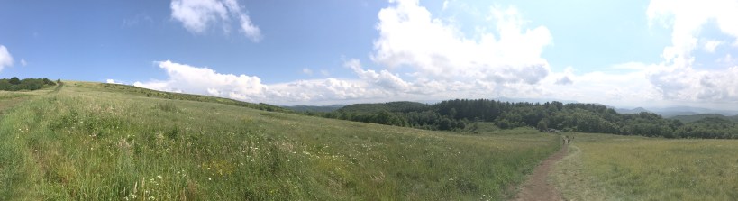
Someone planted a Flag there. There was a steady breeze to keep it waving.

A view from the summit.


The USGS Marker at the top identifies the highest point.


Michelle’s on “Top of the World“

On our ride home, we took Highway 74 though the Nantahala. We stopped at the Nantahala Outdoor Center to snap some photos of the river. It was a little misty and raining so we didn’t venture out long here.


A short distance down from the Nantahala Outdoor Center was this suspension bridge that crossed the river. Naturally we had to investigate.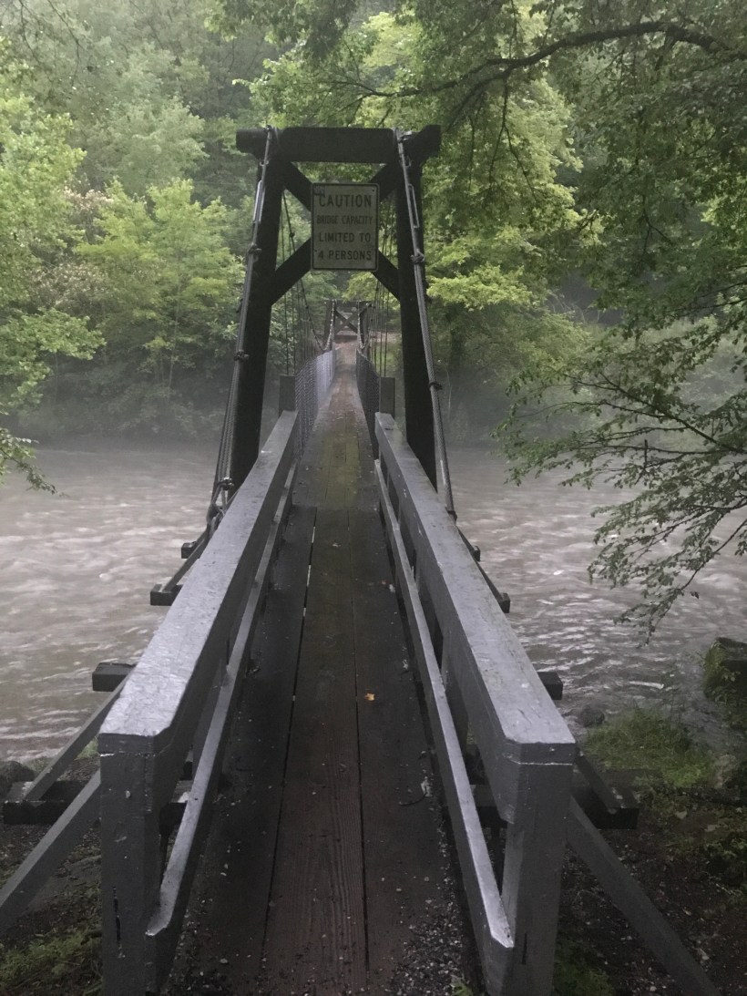


After the Nantahala it was on to home, and preparing for the next adventure.
