
A field of yellow flowered rapeseed. While it has many uses, the most common is to produce canola oil. This field lies at the foothills of West Glacier outside Hungry Horse.
A field of yellow flowered rapeseed. While it has many uses, the most common is to produce canola oil. This field lies at the foothills of West Glacier outside Hungry Horse.

The furthest we’ve ever driven for desert. Their Huckleberry Bearclaw ‘s are worth the drive up from Glacier National Park. It should be added to your must visit places in Montana!

The setting sun shines through one of the arches in the formation known as Parade of Elephants.
As everyone one else was rushing to get into position to take photos of Double, Windows, and Turret Arches, I walked down the road just a little to wait for the sun to align itself perfectly behind the Parade of Elephants. I never imagined I’d get a shot like this!

Grinnell Point stands above Swiftcurrent Lake. The smoothness of the early morning lake creates a mirror image of the surrounding mountains and clouds in the sky.


After:
Once the branches were cut the Jeep cleared it with ease. But due to the angle we entered, the trailer was going to hit. Luckily, Michelle was able to give it just enough boost to raise the tree just the inch we needed. I should have had her swinging the axe 🙂

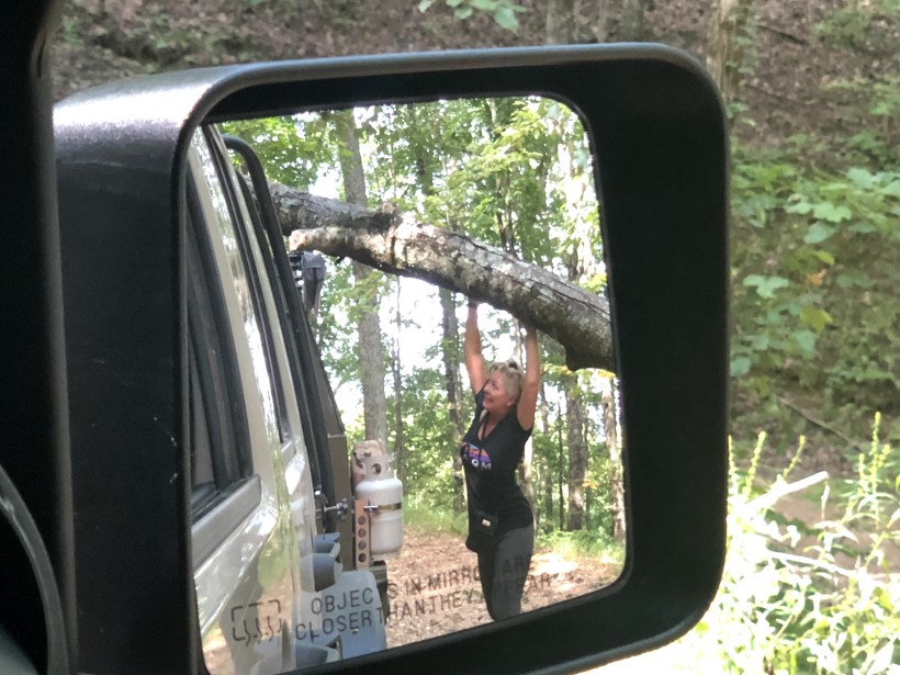
With the tree clear we were on our way. Once on Kimsey Mountain Hwy, it was smooth sailing (still dirt road though) back to State Route 30. From there we headed south towards home.
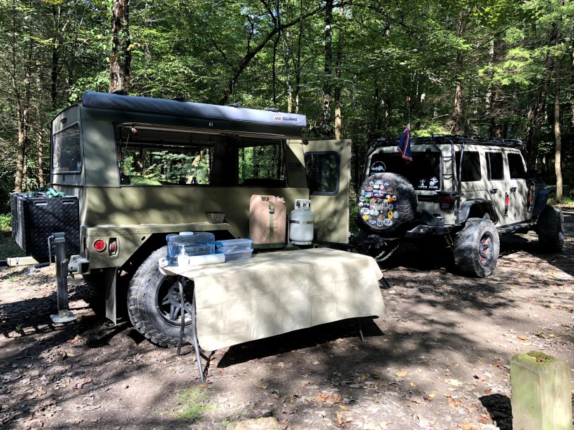
Over the weekend, we decided to takeoff for a quick overnighter into the Cohutta Wilderness. So we packed up the trailer and headed north. We have explored this area plenty of times before, but there were a few trails I wanted to add to my map. The yellow roads were my targets, and the blue routes already explored.

We drove north on 411 through Pine Log, Fairmount, Chatsworth, and then stopped in Eton for a quick lunch before hitting the trails. Paul’s Drive In was right on 411 and sounded good enough for a quick lunch before hitting the trails. A few cheeseburgers later, a quick stop at the gas station next door and all our tanks are full!

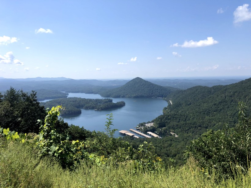
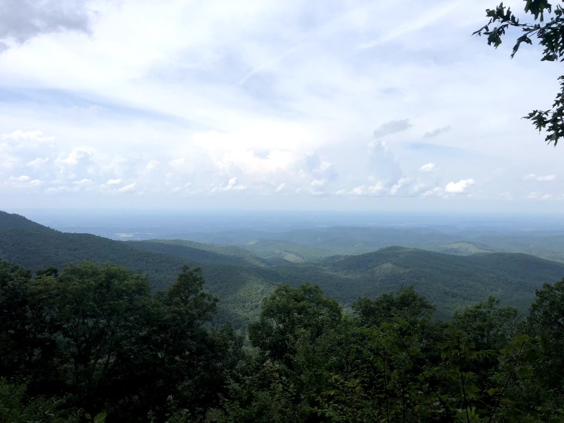
While we could have started in Eton on Old CCC Camp Road, we decided to travel a little further north to Crandall and enter from Mill Creek Road. The first section of this road is paved, but quickly turns to a dirt Forest Service Road. It winds its way for about 10 miles or so before getting to the intersection for Murray Lake or Lake Conasauga and the Hickory Creek Trailhead. The view at the overlook has you looking north-west back towards Cisco, GA. and into Tennessee.

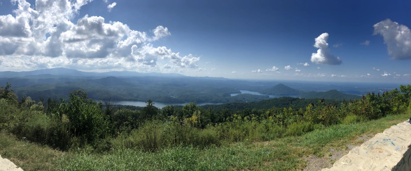
We made a right turn at the intersection (which is West Cow Pen Road) and headed on into the Cohutta Wilderness and Lake Conasauga. About half way along the segment, there is another scenic overlook with a wooden platform. This view has you looking west and while we passed this during the afternoon I high recommend planning a evening to catch the sunset. We did that a few years back and the view was awesome!

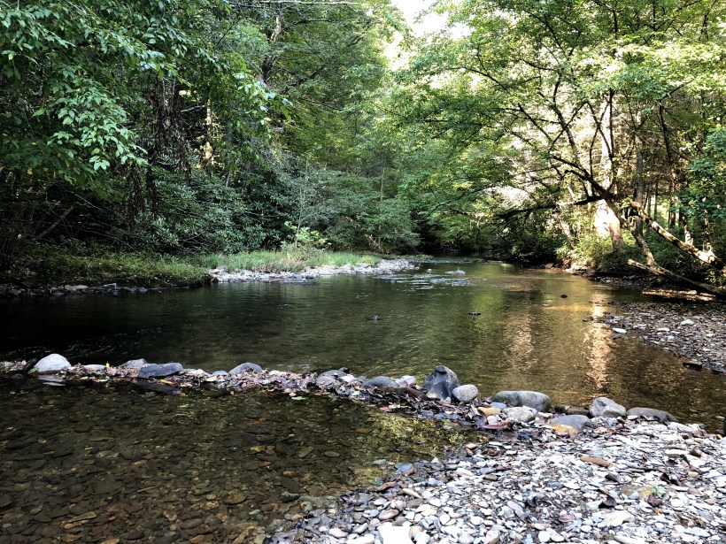
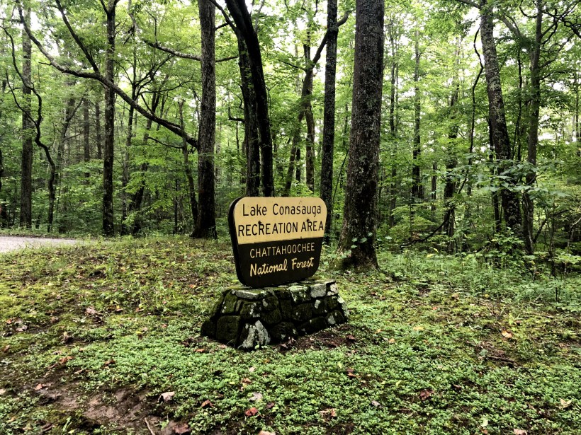
After the overlook, we rode on for another few miles until we arrived at Lake Conasauga. There are about 30 campsites, all primitive with no water or electricity. All of them have a tent pad, picnic table, and there is two restrooms with running water – but no showers.
There are about 7 sites right on the edge of the lake, and another 5 or so close enough to have a good view of the lake. While not big, the lake does have an area for swimming, several fishing spots, and ample room for kayaking. This time we were not fortunate enough to get a spot right on the lake – maybe next time as all the sites are first come, first served.


After setting up camp, I broke out the HF rig to try to make a few contacts. I was able to hear quite a few calling all the way from Ohio, but was never able to fully make a radio connection.


No camp is complete without a campfire!!!
After everyone else in the campground started bedding down, and the majority of the campfires had smouldered out, it was time for a little astrophotography! The lighted area on the horizon must have been the street glow from Ellijay – some 15 miles to the southeast. After a few hours, and our own campfire was burnt out, it was time for bed. It was amazing to fall asleep to the sound of a million crickets and katydids.


The next morning we woke feeling refreshed and ready to do some exploring. After breakfast we took the short hike around the lake. It’s total length is about 1.2 miles.


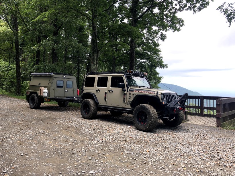
After the hike, we loaded up to go explore. Our custom built offroad trailer is quite capable, and tracks easily behind the jeep, and could probably go almost anywhere the Jeep could.
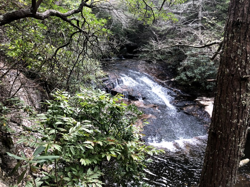
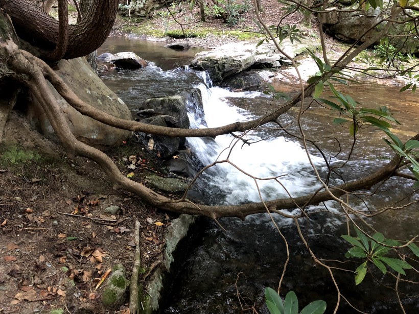
 We drove out Lake Conasauga Road until it intersected back into Old CCC Camp Road. From there we backtracked towards Murray Lake on West Cow Pen Road and then onto Old Hwy 2 (which is all dirt now). From there, we turned onto East Cow Pen Road. They had it posted for control burns, but we thought we would see how far we could get and just maybe it was open all the way through – no luck! From what I know, it really has never been open all the way through during our years of exploring, or either we have been on it and I forgot all about running it. We did come across a few water crossings and waterfalls though, so that made it worthwhile for us.


So from there we backtracked, and headed north on Peavine Sneed Creek Road, and turned off on FSR 221. Oh did I mention at this point we were in Tennessee. We then turned off onto FSR 374 headed towards Hogback Ridge. I had never been on this section, so I was not familiar with it, or if it even went all the way though. We met several vehicles along the way, so that gave me hope that it came out over on the Ocoee River or Lake Ocoee… BUT no luck again. After about 7 miles, we came to the end were .5 miles from both the lake and river on either side of the ridge. SO CLOSE!! Time to back track and head south towards the house.


There are a few other areas I want to explore, so this won’t be our last trip into the Cohutta Wilderness!!!
 Tomorrow we start an epic road trip with several of our friends to Moab, Utah for some off road action. You can follow along for the ride in a number of ways for instant updates.
Or check back here after we return for more Blog post!!!
As you recall in December we went on an 18 day road trip from our home in Georgia to California and back. Now that we have had to get back, and settle back into the groove of work, it is time to reflect, reminisce, and re-live our trip. Over the next few months, I will be recounting our trip here. The following is from our ramblings through the Mojave National Preserve in San Bernardino County, California.
Our first day saw us heading into the Mojave from the South. We got off Interstate 40 onto Kelbaker Road and headed north up towards Kelso.

Originally opened in 1924 as a train station, Kelso Depot wan renovated and reopened in 2005 as the Visitor Center for Mojave National Preserve. Former dormitory rooms contain exhibits describing the cultural and natural history of the surrounding desert. The baggage room, ticket office, and two dormitory rooms have been historically furnished to illustrate life in the depot in the first half of the twentieth century. Read more here.


The Landscape is littered by sand dunes, volcanic cinder cones, Joshua tree forests, and carpets of wildflowers. Each turn or crest of the ridge brings new expansive views. Before we left from the first day, we drove out to the Kelso Dunes. Too bad we didn’t have time to explore more before the sunset on us.


The next came early for us. We started off about 6:00 a.m. from Baker, California. From there we headed East again, on the opposite end of Kelbaker Road. We drove to Aiken Mine Rd and turned to head up to some volcanic cinder cones to look for the lava tubes. Needless to say, we drove right past the main one you can climb down into – “Guess that means we have to go back now”!
Joshua Tree forest scatter across the landscapes here. The Joshua Tree is a form of Yucca plant. Trees only grow an average of 3 inches per year for the first 10 years and from there slow their growth. If it survives the rigors of the desert, it can live for hundreds of years; some specimens survive a thousand years. From the height on some of the ones we saw, like the one pictured here, it most have been around for 100’s of years to grow that large!!

The first major stopping point along our journey was the Mojave mailbox. Here you sign in the logbook, and then leave (or take as needed) some supplies that could benefit you or others. At the base of the mailbox were bottles of water, an American Flag on a staff, and a surfboard – though not quite sure what one would use a surfboard for out in the desert. Inside the mailbox were food rations, flashlights, batteries, pens, papers, maps, knives, sunscreen, and a ton of other miscellaneous items. Since we visited in the dead of December, we left some hand warmer packs.


We signed the log book, and started to head back to the Jeep when we noticed several collections of various items out behind the mailbox. I had read about the Frog Garden, but didn’t know it was so close to the mailbox. There were probably 100’s of frog statues and toys here. We’ll know next trip to bring along some trinkets to add to these collections. Scatter next to the Frog Garden were also a Bobblehead Garden, some Tonka Trucks, Jeep and Gnome Gardens as well.


All along the trail cairns mark the way. You can watch for these stacks of stone along the way to ensure you are on the correct road, as there are many roads and trails that criss cross the desert.

The expanse of the Mojave Desert.


Marl Springs was our next stop. There is an old well and some fencing from an old homestead.


A placard dedicating the Mojave Road.


Next was Government holes with another water supply near Rock Spring, with an old concrete trough. It was a watering stop on the Mojave Road first dug in 1859 and was later used by cattle ranchers until recent times.


In late 1866 an Army post was established at this spot and called Camp Rock Spring, California. It was maintained through 1867 and into 1868 at which time the U.S. Mail was taken off the Mojave Road and the presence of the Army no longer required. Bert Smith built a rock house in the early 1930’s close to Rock Springs.


Another old homestead along the route.


A plaque dedicated to the Nevada Southern Railway that ran through these parts.

As early as the 1980’s as the Mojave was being developed into a recreational trail, a can was placed hanging out over the road. It has become a tradition to deposit a penny into the can as you pass. If the can is too full, you are to add another one. We paid our poll and moved on…


The next point of interest we came across is the old Mojave School Bus. Not sure how or why it got out here or the history of it. I have heard that since we traveled the road that the bus has been removed or relocated by the National Park Service. I am glad we got to experience it.


As far as the eye can see, we had more road to travel but knew we where getting close to the end. Way off in the horizon you could occasionally seen the flicker reflection from 18 wheel trailers on State Highway 95.

One of the last stops along our route was the old Fort Piute. Along the way we passed what remains of the Irwin homestead – mainly turkey pens that they were trying to raise while living here. On past that is the remains of the old Army Post. It was constructed in 1867 by Company D 9th U.S. Infantry and maintained by them until 1868.


The rock corral used to keep the horses in.


Again, follow the cairns to ensure you are on the right route.


Sunset on the Mojave Desert. If we have a chance to run the Mojave Road again, there are sections to the East and West that we missed that we would want to explore and spend more than a day and half here. To really do justice, I think about three days to explore and really soak in the landscape, history, and all the Mojave has to offer.

Until the next time!
